利用 Osmium Tool 提取 OSM 历史时点与公共交通标签数据
📝 摘要: 本文演示如何从 OpenStreetMap 全历史数据中提取指定时点快照,再按公交站、轻轨站、铁路站和轮渡码头等标签筛选要素,最终在 QGIS 中加载并导出为 Shapefile。适合需要开展历史 POI、交通设施演变或时空 GIS 分析的读者。
关键词: OpenStreetMap、Osmium Tool、历史数据、标签过滤、公共交通、QGIS 适合对象: GIS 学习者、空间数据工程师、城市交通研究人员
文章目录
- 利用 Osmium Tool 提取 OSM 历史时点与公共交通标签数据
-
- 01 为什么需要提取 OSM 历史标签数据?
- 02 数据与软件准备
-
- 2.1 数据来源
- 2.2 软件环境
- 03 在虚拟机中挂载 Windows 共享文件夹
-
- 3.1 打开终端
- 3.2 创建挂载目录并挂载共享文件夹
- 04 将历史 PBF 文件复制到工作目录
- 05 从全历史数据提取指定时点快照
-
- 5.1 时间过滤的含义
- 5.2 执行时点提取
- 5.3 校验输出
- 06 按 OSM 标签提取公共交通设施
-
- 6.1 单标签提取
- 6.2 批量提取四类设施
- 6.3 一次输出多个标签
- 6.4 可选:限制对象类型
- 07 将 PBF 转换为 QGIS 可读数据
-
- 7.1 按草案方式转换为 `.osm`
- 7.2 推荐的 Osmium 等价写法
- 08 将结果传回 Windows 并在 QGIS 中加载
-
- 8.1 复制到共享目录
- 8.2 在 QGIS 中打开 OSM 文件
- 09 导出为 Shapefile 或 GeoPackage
- 10 结果检查与效果展示
- 11 一键批处理脚本
- 12 常见问题排查
-
- 12.1 `time-filter` 报错或输出为空
- 12.2 输出文件已存在
- 12.3 QGIS 中出现多个子图层
- 12.4 标签结果与预期不一致
- 13 方法边界与研究建议
- 14 总结
01 为什么需要提取 OSM 历史标签数据?
OpenStreetMap(OSM)不仅保存当前地图状态,还维护对象的历史版本。对于城市交通设施演变、兴趣点更新、道路网络扩张和地图贡献行为分析,仅使用最新快照往往无法回答“某一年当时是什么样”的问题。
本文采用一条清晰的数据处理链:
#mermaid-svg-I5ls4tOtBEJ5l6QV{font-family:\”trebuchet ms\”,verdana,arial,sans-serif;font-size:16px;fill:#333;}@keyframes edge-animation-frame{from{stroke-dashoffset:0;}}@keyframes dash{to{stroke-dashoffset:0;}}#mermaid-svg-I5ls4tOtBEJ5l6QV .edge-animation-slow{stroke-dasharray:9,5!important;stroke-dashoffset:900;animation:dash 50s linear infinite;stroke-linecap:round;}#mermaid-svg-I5ls4tOtBEJ5l6QV .edge-animation-fast{stroke-dasharray:9,5!important;stroke-dashoffset:900;animation:dash 20s linear infinite;stroke-linecap:round;}#mermaid-svg-I5ls4tOtBEJ5l6QV .error-icon{fill:#552222;}#mermaid-svg-I5ls4tOtBEJ5l6QV .error-text{fill:#552222;stroke:#552222;}#mermaid-svg-I5ls4tOtBEJ5l6QV .edge-thickness-normal{stroke-width:1px;}#mermaid-svg-I5ls4tOtBEJ5l6QV .edge-thickness-thick{stroke-width:3.5px;}#mermaid-svg-I5ls4tOtBEJ5l6QV .edge-pattern-solid{stroke-dasharray:0;}#mermaid-svg-I5ls4tOtBEJ5l6QV .edge-thickness-invisible{stroke-width:0;fill:none;}#mermaid-svg-I5ls4tOtBEJ5l6QV .edge-pattern-dashed{stroke-dasharray:3;}#mermaid-svg-I5ls4tOtBEJ5l6QV .edge-pattern-dotted{stroke-dasharray:2;}#mermaid-svg-I5ls4tOtBEJ5l6QV .marker{fill:#333333;stroke:#333333;}#mermaid-svg-I5ls4tOtBEJ5l6QV .marker.cross{stroke:#333333;}#mermaid-svg-I5ls4tOtBEJ5l6QV svg{font-family:\”trebuchet ms\”,verdana,arial,sans-serif;font-size:16px;}#mermaid-svg-I5ls4tOtBEJ5l6QV p{margin:0;}#mermaid-svg-I5ls4tOtBEJ5l6QV .label{font-family:\”trebuchet ms\”,verdana,arial,sans-serif;color:#333;}#mermaid-svg-I5ls4tOtBEJ5l6QV .cluster-label text{fill:#333;}#mermaid-svg-I5ls4tOtBEJ5l6QV .cluster-label span{color:#333;}#mermaid-svg-I5ls4tOtBEJ5l6QV .cluster-label span p{background-color:transparent;}#mermaid-svg-I5ls4tOtBEJ5l6QV .label text,#mermaid-svg-I5ls4tOtBEJ5l6QV span{fill:#333;color:#333;}#mermaid-svg-I5ls4tOtBEJ5l6QV .node rect,#mermaid-svg-I5ls4tOtBEJ5l6QV .node circle,#mermaid-svg-I5ls4tOtBEJ5l6QV .node ellipse,#mermaid-svg-I5ls4tOtBEJ5l6QV .node polygon,#mermaid-svg-I5ls4tOtBEJ5l6QV .node path{fill:#ECECFF;stroke:#9370DB;stroke-width:1px;}#mermaid-svg-I5ls4tOtBEJ5l6QV .rough-node .label text,#mermaid-svg-I5ls4tOtBEJ5l6QV .node .label text,#mermaid-svg-I5ls4tOtBEJ5l6QV .image-shape .label,#mermaid-svg-I5ls4tOtBEJ5l6QV .icon-shape .label{text-anchor:middle;}#mermaid-svg-I5ls4tOtBEJ5l6QV .node .katex path{fill:#000;stroke:#000;stroke-width:1px;}#mermaid-svg-I5ls4tOtBEJ5l6QV .rough-node .label,#mermaid-svg-I5ls4tOtBEJ5l6QV .node .label,#mermaid-svg-I5ls4tOtBEJ5l6QV .image-shape .label,#mermaid-svg-I5ls4tOtBEJ5l6QV .icon-shape .label{text-align:center;}#mermaid-svg-I5ls4tOtBEJ5l6QV .node.clickable{cursor:pointer;}#mermaid-svg-I5ls4tOtBEJ5l6QV .root .anchor path{fill:#333333!important;stroke-width:0;stroke:#333333;}#mermaid-svg-I5ls4tOtBEJ5l6QV .arrowheadPath{fill:#333333;}#mermaid-svg-I5ls4tOtBEJ5l6QV .edgePath .path{stroke:#333333;stroke-width:2.0px;}#mermaid-svg-I5ls4tOtBEJ5l6QV .flowchart-link{stroke:#333333;fill:none;}#mermaid-svg-I5ls4tOtBEJ5l6QV .edgeLabel{background-color:rgba(232,232,232, 0.8);text-align:center;}#mermaid-svg-I5ls4tOtBEJ5l6QV .edgeLabel p{background-color:rgba(232,232,232, 0.8);}#mermaid-svg-I5ls4tOtBEJ5l6QV .edgeLabel rect{opacity:0.5;background-color:rgba(232,232,232, 0.8);fill:rgba(232,232,232, 0.8);}#mermaid-svg-I5ls4tOtBEJ5l6QV .labelBkg{background-color:rgba(232, 232, 232, 0.5);}#mermaid-svg-I5ls4tOtBEJ5l6QV .cluster rect{fill:#ffffde;stroke:#aaaa33;stroke-width:1px;}#mermaid-svg-I5ls4tOtBEJ5l6QV .cluster text{fill:#333;}#mermaid-svg-I5ls4tOtBEJ5l6QV .cluster span{color:#333;}#mermaid-svg-I5ls4tOtBEJ5l6QV div.mermaidTooltip{position:absolute;text-align:center;max-width:200px;padding:2px;font-family:\”trebuchet ms\”,verdana,arial,sans-serif;font-size:12px;background:hsl(80, 100%, 96.2745098039%);border:1px solid #aaaa33;border-radius:2px;pointer-events:none;z-index:100;}#mermaid-svg-I5ls4tOtBEJ5l6QV .flowchartTitleText{text-anchor:middle;font-size:18px;fill:#333;}#mermaid-svg-I5ls4tOtBEJ5l6QV rect.text{fill:none;stroke-width:0;}#mermaid-svg-I5ls4tOtBEJ5l6QV .icon-shape,#mermaid-svg-I5ls4tOtBEJ5l6QV .image-shape{background-color:rgba(232,232,232, 0.8);text-align:center;}#mermaid-svg-I5ls4tOtBEJ5l6QV .icon-shape p,#mermaid-svg-I5ls4tOtBEJ5l6QV .image-shape p{background-color:rgba(232,232,232, 0.8);padding:2px;}#mermaid-svg-I5ls4tOtBEJ5l6QV .icon-shape .label rect,#mermaid-svg-I5ls4tOtBEJ5l6QV .image-shape .label rect{opacity:0.5;background-color:rgba(232,232,232, 0.8);fill:rgba(232,232,232, 0.8);}#mermaid-svg-I5ls4tOtBEJ5l6QV .label-icon{display:inline-block;height:1em;overflow:visible;vertical-align:-0.125em;}#mermaid-svg-I5ls4tOtBEJ5l6QV .node .label-icon path{fill:currentColor;stroke:revert;stroke-width:revert;}#mermaid-svg-I5ls4tOtBEJ5l6QV :root{–mermaid-font-family:\”trebuchet ms\”,verdana,arial,sans-serif;}
OSM 全历史 PBF
time-filter 时点快照
tags-filter 标签筛选
PBF 转 OSM 或直接导出
QGIS 加载
导出 Shapefile / GeoPackage
本案例以 2020 年末公共交通设施快照 为例,提取以下四类标签:
| 公交站点 | highway=bus_stop | 公交车辆常规停靠点 |
| 有轨电车站 | railway=tram_stop | 有轨电车停靠点 |
| 铁路/轨道站点 | railway=station | 铁路、地铁或其他轨道交通车站,需结合附加标签进一步判别 |
| 轮渡码头 | amenity=ferry_terminal | 旅客上下轮渡的码头或终端设施 |
[!IMPORTANT] railway=station 的语义范围较宽,并不天然等同于“地铁站”。若研究对象只包括地铁,应结合 station=subway、subway=yes、network=* 等标签进一步过滤或复核。
02 数据与软件准备
2.1 数据来源
本流程需要的是 OSM 全历史文件,而不是普通的当前快照文件。全历史数据包含同一对象在不同时间的多个版本,文件通常很大。
常用资料入口:
- OSM Planet Full History 数据目录
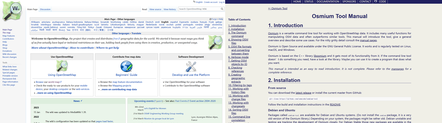
- OpenStreetMap Wiki
- Osmium Tool 最新手册
::: warning 存储与计算资源 全球全历史数据体量非常大。实际项目宜先确认磁盘空间、内存和处理时间;若研究区域较小,可优先使用区域历史数据或先做空间裁剪。 :::
2.2 软件环境
草案采用以下组合:
- Windows 主机;
- VMware 中的 Ubuntu Linux 虚拟机;
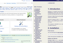
- osmium-tool;
- osmconvert;
- QGIS。
建议先检查命令是否可用:
osmium –version
osmconvert –help | head
Ubuntu/Debian 系统可尝试:
sudo apt update
sudo apt install osmium-tool osmctools
[!NOTE] 软件包名称会因 Linux 发行版与软件源而异。安装后应以 osmium –version 和 osmconvert –help 的实际输出为准。
03 在虚拟机中挂载 Windows 共享文件夹
3.1 打开终端
在 Ubuntu 桌面按下 Ctrl + Alt + T,打开终端。
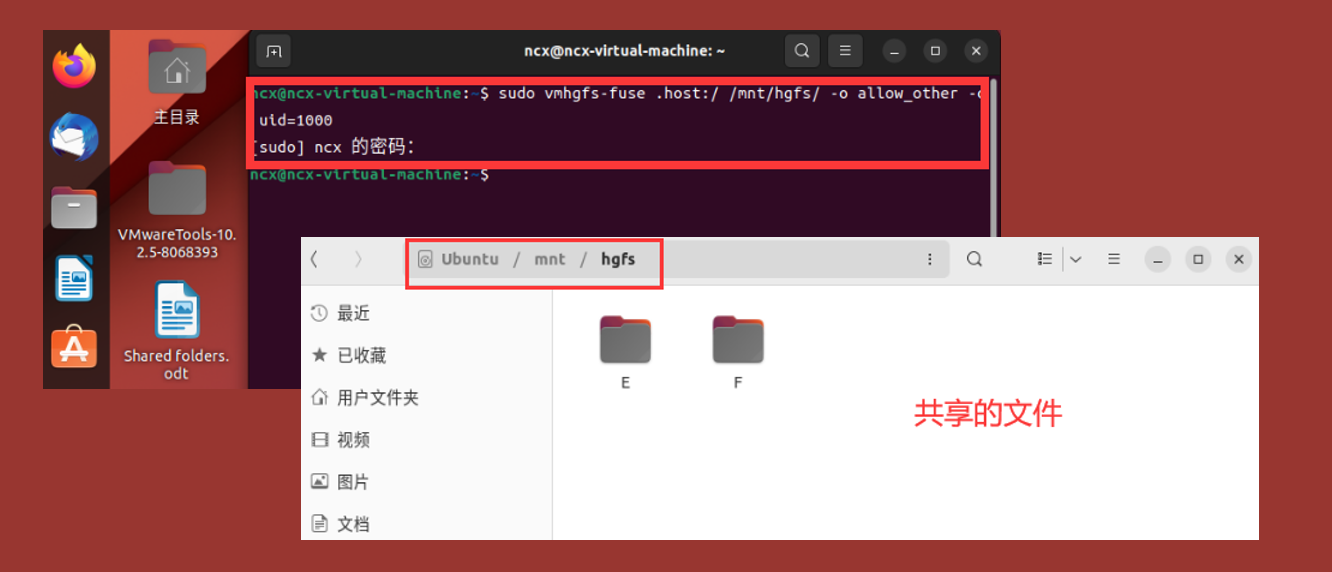
3.2 创建挂载目录并挂载共享文件夹
sudo mkdir -p /mnt/hgfs
sudo vmhgfs-fuse .host:/ /mnt/hgfs/ \\
-o allow_other \\
-o uid=1000
输入当前 Linux 用户密码后,可在 /mnt/hgfs/ 下访问 VMware 已配置的 Windows 共享目录。
[!TIP] 若 uid 不是 1000,可先运行 id -u 获取当前用户 ID,再替换命令中的参数值。
04 将历史 PBF 文件复制到工作目录
为减少路径输入错误,建议建立独立工作目录:
mkdir -p ~/work/osmium-tool
cd ~/work/osmium-tool
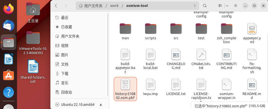
将共享目录中的历史文件复制到工作目录。以下文件名沿用草案示例:
cp /mnt/hgfs/<共享目录>/history-210802.osm.pbf \\
~/work/osmium-tool/history-210802.osm.pbf
检查文件是否存在及其大小:
ls -lh ~/work/osmium-tool/history-210802.osm.pbf
osmium fileinfo ~/work/osmium-tool/history-210802.osm.pbf
::: tip 文件扩展名说明 Osmium 手册常以 .osh.pbf 表示历史 PBF,以 .osm.pbf 表示普通快照。草案文件使用 .osm.pbf 命名,但真正能否执行 time-filter 取决于文件内容是否包含历史版本。建议用 osmium fileinfo 核验,而不要只依据扩展名判断。 :::
05 从全历史数据提取指定时点快照
5.1 时间过滤的含义
osmium time-filter 可从历史文件中还原某个时间点有效的 OSM 对象。单一时间参数表示“该时刻地图应呈现的状态”,输出为普通 OSM 快照,不再包含完整版本历史。
本文选择 2020 年最后一秒:
2020-12-31T23:59:59Z
其中 Z 表示 UTC。该时间点可理解为“2020 年末快照”,而不是“2020 年期间所有曾经出现过的对象集合”。
5.2 执行时点提取
osmium time-filter \\
history-210802.osm.pbf \\
2020-12-31T23:59:59Z \\
-o 2020.osm.pbf \\
–progress
使用绝对路径时:
osmium time-filter \\
/path/to/input/history-210802.osm.pbf \\
2020-12-31T23:59:59Z \\
-o /path/to/output/2020.osm.pbf \\
–progress
若输出文件已存在,可在确认允许覆盖后加入 -O:
osmium time-filter -O \\
history-210802.osm.pbf \\
2020-12-31T23:59:59Z \\
-o 2020.osm.pbf

5.3 校验输出
ls -lh 2020.osm.pbf
osmium fileinfo 2020.osm.pbf
[!WARNING] 草案文字与截图中分别出现了 2020-12-31T23:59:59Z 和 2020-01-01T00:00:00Z。二者代表不同快照:前者接近 2020 年末,后者是 2020 年初。正式分析必须统一时间定义,并在论文或报告中写明采用 UTC 还是本地时间。
06 按 OSM 标签提取公共交通设施
6.1 单标签提取
以公交站为例:
osmium tags-filter \\
2020.osm.pbf \\
highway=bus_stop \\
-o bus_stop.pbf \\
–progress
使用绝对路径时:
osmium tags-filter \\
/path/to/output/2020.osm.pbf \\
highway=bus_stop \\
-o /path/to/output/bus_stop.pbf \\
–progress
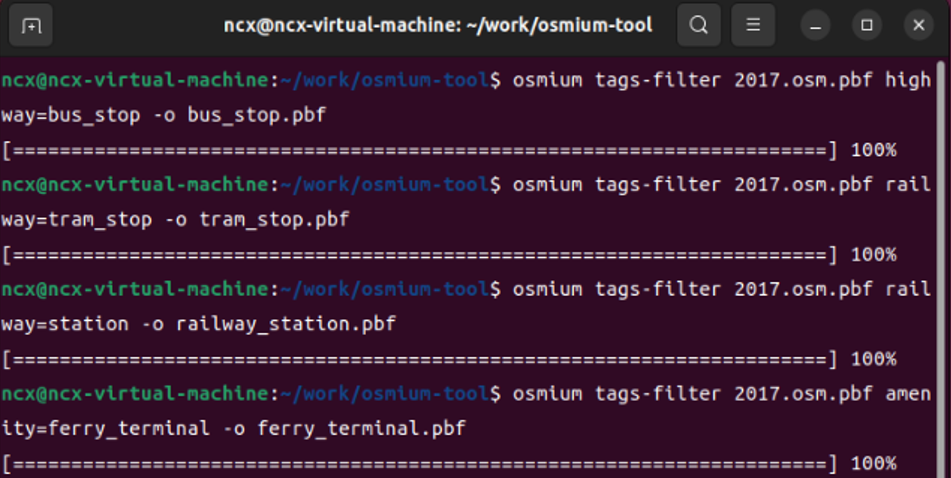
6.2 批量提取四类设施
osmium tags-filter 2020.osm.pbf highway=bus_stop \\
-o bus_stop.pbf –progress
osmium tags-filter 2020.osm.pbf railway=tram_stop \\
-o tram_stop.pbf –progress
osmium tags-filter 2020.osm.pbf railway=station \\
-o railway_station.pbf –progress
osmium tags-filter 2020.osm.pbf amenity=ferry_terminal \\
-o ferry_terminal.pbf –progress
6.3 一次输出多个标签
若后续分析不要求四类设施分别存成文件,也可以在同一命令中写入多个表达式。tags-filter 对多个表达式采用“至少匹配一个”的逻辑:
osmium tags-filter 2020.osm.pbf \\
highway=bus_stop \\
railway=tram_stop \\
railway=station \\
amenity=ferry_terminal \\
-o public_transport_2020.osm.pbf \\
–progress
[!IMPORTANT] tags-filter 默认会加入匹配要素所引用的节点或关系成员,以维持几何引用完整性。因此,输出文件中可能包含一些本身不带目标标签的辅助对象。这属于正常现象。
6.4 可选:限制对象类型
如果只想匹配节点,可在表达式前加入 n/:
osmium tags-filter 2020.osm.pbf \\
n/highway=bus_stop \\
n/railway=tram_stop \\
n/railway=station \\
n/amenity=ferry_terminal \\
-o public_transport_nodes_2020.osm.pbf
但在真实 OSM 数据中,车站或轮渡设施也可能被建模为面或关系。是否限制为节点,应由研究目的决定。
07 将 PBF 转换为 QGIS 可读数据
7.1 按草案方式转换为 .osm
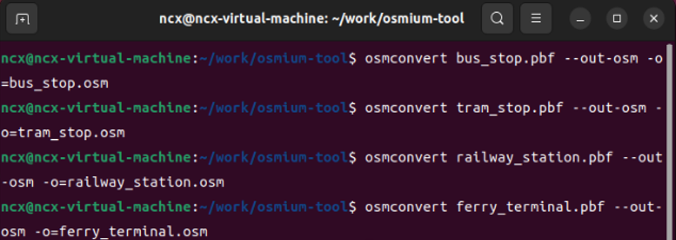
osmconvert bus_stop.pbf –out-osm -o=bus_stop.osm
osmconvert tram_stop.pbf –out-osm -o=tram_stop.osm
osmconvert railway_station.pbf –out-osm -o=railway_station.osm
osmconvert ferry_terminal.pbf –out-osm -o=ferry_terminal.osm
7.2 推荐的 Osmium 等价写法
若不希望额外安装 osmconvert,可使用 Osmium 自身进行格式转换:
osmium cat bus_stop.pbf -o bus_stop.osm
osmium cat tram_stop.pbf -o tram_stop.osm
osmium cat railway_station.pbf -o railway_station.osm
osmium cat ferry_terminal.pbf -o ferry_terminal.osm
[!TIP] 对于大数据,XML 格式的 .osm 通常比 PBF 占用更多磁盘空间、读取也更慢。若 QGIS/插件能够直接读取 .osm.pbf,可优先保留 PBF;用于长期 GIS 项目时,也可考虑导出为 GeoPackage。
08 将结果传回 Windows 并在 QGIS 中加载
8.1 复制到共享目录
cp *.osm /mnt/hgfs/<共享目录>/
8.2 在 QGIS 中打开 OSM 文件
在 QGIS 中通过“数据源管理器”或直接拖拽方式添加 .osm 文件。QGIS 通常会列出以下子图层:
- points;
- lines;
- multilinestrings;
- multipolygons;
- other_relations。
对于公交站等点状设施,一般选择 points 图层;对于以面建模的站场或码头,还需检查 multipolygons。
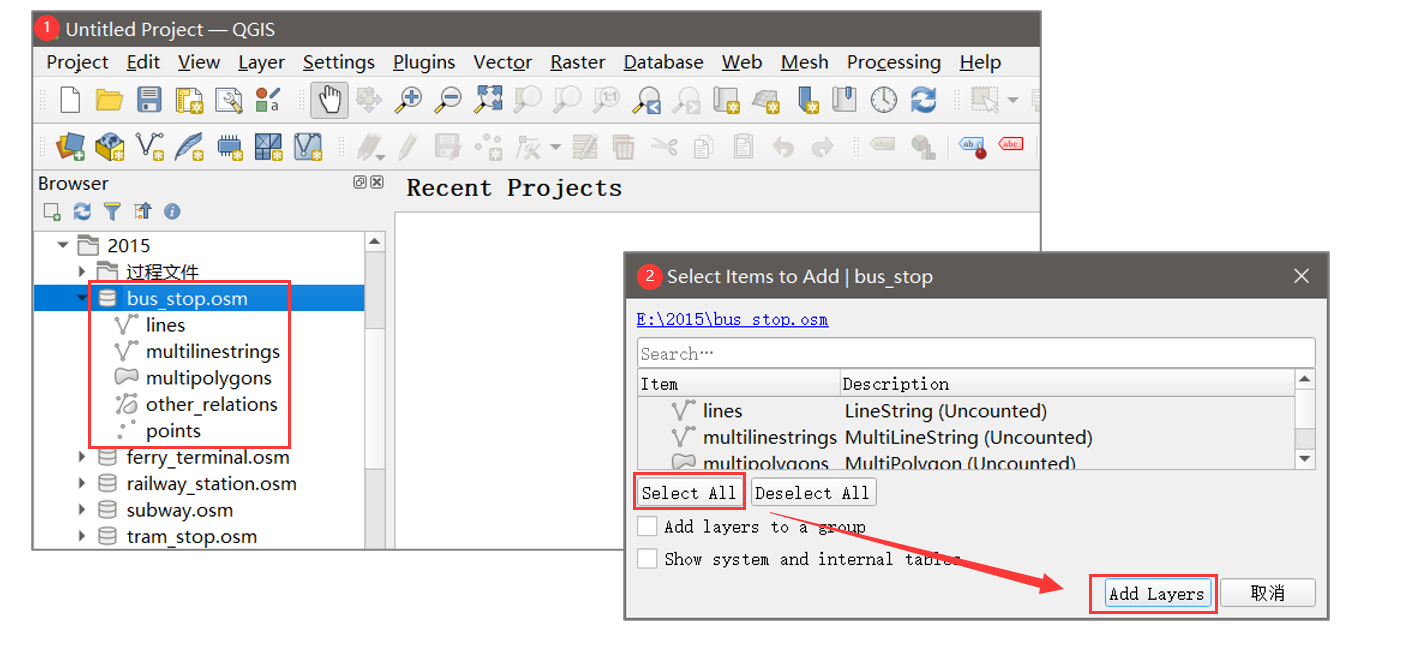
[!NOTE] 截图展示的是较早版本 QGIS 界面。不同版本的菜单名称和按钮位置可能略有差异,但核心步骤仍是:加载 OSM 数据、选择几何子图层、检查属性字段。
09 导出为 Shapefile 或 GeoPackage
在目标图层上右键,选择:
导出 → 另存为要素……
主要参数建议如下:
| 格式 | ESRI Shapefile 或 GeoPackage | GeoPackage 对字段名、编码和多图层支持更好 |
| 文件编码 | UTF-8 | 减少中文属性乱码 |
| 坐标参考系 | 根据项目需求设置 | OSM 原始经纬度通常采用 WGS 84(EPSG:4326) |
| 几何类型 | 与当前子图层一致 | 点、线、面不可混用 |
| 仅保存选中要素 | 按需 | 用于二次筛选后的输出 |
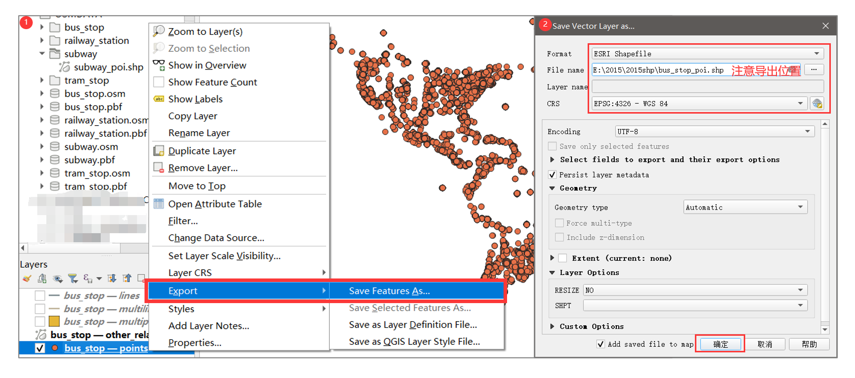
::: warning Shapefile 的限制 Shapefile 字段名较短、字段类型受限,并由多个同名文件共同组成。若没有兼容性要求,推荐优先使用 GeoPackage(.gpkg)保存结果。 :::
10 结果检查与效果展示
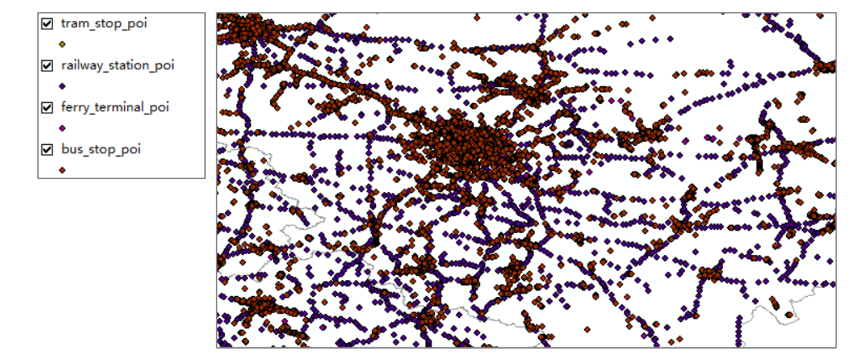
完成导出后,应至少检查以下内容:
- 输出图层能够正常加载;
- 要素数量不是 0;
- 几何类型符合预期;
- 属性表中保留了目标标签;
- 中文名称没有乱码;
- 数据时间点与研究设计一致;
- 不同交通类型没有因宽泛标签而大量混淆;
- 抽样核对若干点位与 OSM 地图或历史页面是否一致。
11 一键批处理脚本
以下 Bash 脚本将“时点快照—标签提取—格式转换”串联起来。运行前只需修改输入文件和时间参数。
#!/usr/bin/env bash
set -euo pipefail
HISTORY_FILE="history-210802.osm.pbf"
SNAPSHOT_TIME="2020-12-31T23:59:59Z"
SNAPSHOT_FILE="2020.osm.pbf"
# 1. 从全历史文件恢复指定时点快照。
osmium time-filter \\
"$HISTORY_FILE" \\
"$SNAPSHOT_TIME" \\
-o "$SNAPSHOT_FILE" \\
–progress
# 2. 定义“输出文件名:OSM 标签表达式”。
declare -A FILTERS=(
[bus_stop]="highway=bus_stop"
[tram_stop]="railway=tram_stop"
[railway_station]="railway=station"
[ferry_terminal]="amenity=ferry_terminal"
)
# 3. 分别提取,并转换为 OSM XML。
for name in "${!FILTERS[@]}"; do
expression="${FILTERS[$name]}"
osmium tags-filter \\
"$SNAPSHOT_FILE" \\
"$expression" \\
-o "${name}.pbf" \\
–progress
osmium cat "${name}.pbf" -o "${name}.osm"
done
echo "处理完成。"
保存为 extract_public_transport.sh 后执行:
chmod +x extract_public_transport.sh
./extract_public_transport.sh
[!WARNING] 脚本默认不覆盖已有文件。重复运行前,应备份或删除旧输出;也可在明确了解后果时,为相关 Osmium 命令加入 -O。
12 常见问题排查
12.1 time-filter 报错或输出为空
可能原因:
排查命令:
osmium fileinfo history-210802.osm.pbf
ls -lh history-210802.osm.pbf
df -h
12.2 输出文件已存在
Osmium 默认拒绝覆盖。确认无误后使用 -O:
osmium tags-filter -O 2020.osm.pbf \\
highway=bus_stop \\
-o bus_stop.pbf
12.3 QGIS 中出现多个子图层
.osm 是包含多种几何对象的容器。公交站通常位于 points,但车站与码头可能同时出现在点或面图层。应根据标签字段和研究需求选择或合并。
12.4 标签结果与预期不一致
OSM 使用社区协作标注,同类设施可能存在多种标注方案。建议:
- 在 OpenStreetMap Wiki 和 Taginfo 中核对标签语义与使用量;
- 同时考虑 public_transport=* 新式公共交通标签;
- 对宽泛标签加入二级条件;
- 对研究区进行抽样人工核查。
13 方法边界与研究建议
本文流程恢复的是 指定时点的 OSM 地图状态。它反映该时刻 OSM 数据库中已记录的对象,而不必然等同于现实世界中设施的真实建成或启用日期。
因此,在学术研究中应区分:
三者可能并不一致。若用于严谨的城市演变研究,宜结合政府开放数据、历史影像、运营资料或实地记录进行交叉验证。
14 总结
整个流程可以概括为四个核心动作:
真正决定结果质量的,不只是命令能否运行,还包括 时间点定义、标签语义、几何类型和结果校验。这些环节应在正式分析前统一设计。
参考资料:
- Osmium Tool:time-filter 手册
- Osmium Tool:tags-filter 手册
- Osmium Tool:fileinfo 手册
- OpenStreetMap Wiki
- OSM Planet Full History
#OpenStreetMap #OsmiumTool #OSM历史数据 #标签过滤 #公共交通 #QGIS #GIS数据处理